The Silver Comet Trail and Cobb and Paulding Home Values
Atlanta Real Estate Market

Atlanta Real Estate Market
Silver Comet Trail home values come up in almost every conversation about buying in Smyrna, Mableton, Powder Springs, Hiram, or Dallas. The trail is a genuine regional asset, and proximity to it is a real amenity that buyers ask for by name. What is less clear, and what deserves an honest answer, is how much a trail-adjacent address is actually worth. The available research supports some claims and does not support others.
What follows is an analysis of published data, with the sourcing labeled so you can see which findings are national, which are Atlanta-specific, and which do not exist. It is not a prediction about any individual property.
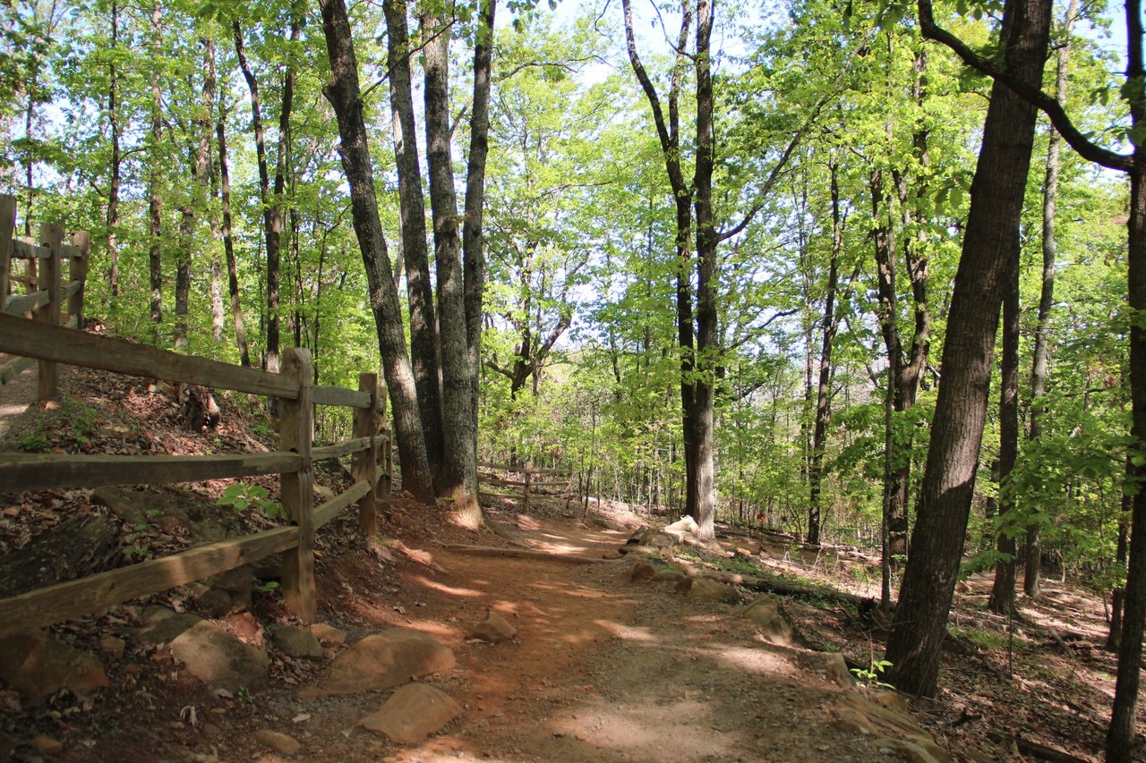
The Silver Comet is a paved, non-motorized rail trail running west from Smyrna through Cobb, Paulding, and Polk counties to the Georgia and Alabama state line. Cobb County's page describes a 12.8 mile Cobb section beginning in Smyrna, managed by the Cobb Department of Transportation, following the abandoned railroad line once traveled by the Silver Comet passenger train.
Published length figures vary. Cobb County's own page says the complete trail will eventually extend 57 miles across Cobb, Paulding, and Polk. Other sources put the current trail at 61.5 miles from the Mavell Road Trailhead in Smyrna to the state line near Cedartown. Because the Silver Comet connects to Alabama's 33 mile Chief Ladiga Trail, the combined paved run reaches roughly 94 miles, which makes it one of the longest paved rail trails in the country.
Cobb lists six trailheads: Florence Road in Powder Springs, Floyd Road in Mableton at the Silver Comet Depot, Heritage Park in Mableton, and Mavell Road, Concord Road, and Oakdale Road in Smyrna. In Paulding the trail runs through Hiram, behind the chamber of commerce in Dallas, through the Paulding Wildlife Management Area, and west toward Braswell.
The Seaboard Air Line ran the Silver Comet passenger train from 1947 to 1969, and the rail line was abandoned in 1989. The Georgia Department of Transportation purchased the corridor that year, the trail was proposed in 1992, construction began in 1998, and the main line was completed in 2008. The full system now includes 21 trailheads. Cobb's Silver Comet Trail page carries the county's operating rules, including daylight hours only and leashed pets.
Yes, in pieces, and the timeline has moved more than once. The Silver Comet Connector is intended to close the gap between the trail's eastern end and the Atlanta BeltLine.
On the Atlanta side, the Woodall Rail Trail, a completed 0.7 mile segment, opened in 2025 and branches from the BeltLine's Westside Trail. Additional intown segments between Chattahoochee Avenue and Marietta Boulevard had clearance work completed in late 2025, and a nearly two mile Whetstone Creek Trail links Marietta Road to Bolton Road. Georgia Trend reported in July 2026 that the Silver Comet Connector was extended to the Woodall Rail Trail along Woodall Creek, and that when finished in 2027 the connector will run through the Upper Westside toward Cobb County.
The Cobb link is the unresolved piece. Cobb committed more than $8 million to a roughly one mile segment from Plant Atkinson Road to Atlanta Road in Vinings. As of October 2025, a gap remained along Plant Atkinson Road, with the county's communications director stating that the DOT was working with the PATH Foundation to determine the path forward and that the county was just beginning work to determine how to acquire the necessary property. No completion date had been announced. A 2023 zoning application that would have included a land donation was withdrawn after community opposition.
The honest framing for a buyer is that the connector is under construction on the Atlanta side and unresolved on the Cobb side. Anyone pricing a home today on the assumption of a completed Cobb to BeltLine link is pricing an event with no announced date.
Here is where discipline matters. There is no published study of Silver Comet proximity and home sale prices that we could locate and verify. Claims that homes near the Silver Comet sell for a specific percentage more are not supported by anything we could source. What exists is three separate bodies of evidence, and they should be labeled as such.
A synthesis published by Headwaters Economics reports that trail proximity premiums in the research literature typically fall in a 2 to 20 percent range. Individual studies vary widely: a 2009 San Antonio study found a 2 percent premium for neighborhood trails and 5 percent with greenbelts; a 2008 study of the Little Miami Scenic Trail in southwest Ohio found roughly a $7 increase in value for every foot closer to the trail; a 2006 New Castle County, Delaware study found 4 percent within 50 meters; and a 2004 Indianapolis study found an 11 percent premium within a half mile. None of this research is Georgia-specific.
The closest local evidence comes from the BeltLine rather than the Silver Comet. Published analysis has found properties within a quarter mile of the BeltLine showing substantially higher values than comparison areas, and 2011 to 2015 data showing materially higher appreciation for homes within a half mile. Research by Dan Immergluck using 2000 to 2006 sales concluded that the BeltLine announcement itself drove premiums on the southside and induced speculation. That is a useful analogy for what a completed, heavily used urban trail can do. It is not a measurement of the Silver Comet.
A 2013 study prepared for the Northwest Georgia Regional Commission estimated approximately 390,000 tourist trips annually, about $20 million in annual visitor spending, and roughly $3.5 million in annual state tax revenue from the then 61 mile trail. On property specifically, it projected $650,000 to $2 million in additional annual property tax revenue from residential development near the trail, while explicitly noting uncertainty about how much of that development would be genuinely new rather than displaced from elsewhere in the region. More recently, Georgia Trend reported the trail network contributes an estimated $118 million annually to the regional economy and attracts more than 1.9 million users per year.
Read together, the record supports saying the Silver Comet is a heavily used regional amenity with documented economic impact, and that trail proximity generally carries a measurable premium in the broader research. It does not support a specific number for a specific Cobb or Paulding street. The Silver Comet economic impact summary is worth reading directly if you want the underlying assumptions.
Treat trail access the way you would treat any amenity: as a demand factor that shows up in comparable sales, not as a number you add to a price.
Distinguish between trail-adjacent and trail-accessible. Jurisdiction matters here too, since the trail crosses several, and our explainer on why the county line matters when you buy covers how that plays out. A home backing directly to the corridor is a different product than a home a half mile from a trailhead with no safe pedestrian route to it. Walk the actual route from the front door to the nearest access point. Also ask about the corridor itself: fencing, screening, lighting, parking spillover on event weekends, and any easement running through the lot.
Trail access is worth marketing specifically, with the trailhead named and the distance measured, rather than vaguely. Sellers weighing what to do before listing should also read our guide on renovating before selling a Marietta home. The pricing decision still has to come from a property-level market analysis against recent comparable sales in the same submarket, with full open-market exposure. If nearby comparables that also have trail access sold at a premium, that premium is already in the data and does not need to be argued separately.
If the Cobb to BeltLine link is completed, the eastern end of the trail becomes a different asset than it is today. That is a reasonable thing to find attractive and an unreasonable thing to pay for in advance, given that the right of way question was still unresolved as of late 2025. Owners in Smyrna and Vinings should follow the county's updates rather than the press releases.
How long is the Silver Comet Trail? Cobb County's page says the complete trail will eventually extend 57 miles across Cobb, Paulding, and Polk. Other sources put the current trail at 61.5 miles to the Alabama line, where it joins the 33 mile Chief Ladiga Trail for a combined run of roughly 94 paved miles.
Do homes near the Silver Comet sell for more? There is no published study measuring Silver Comet proximity against home sale prices. National trail research generally finds premiums in a 2 to 20 percent range, and Atlanta BeltLine research finds significant local effects, but neither is a measurement of this trail.
Is the trail connected to the Atlanta BeltLine? Not yet. Atlanta-side segments including the Woodall Rail Trail are built, and the connector is projected to finish in 2027, but the Cobb segment along Plant Atkinson Road still had an unresolved right of way question as of October 2025.
Where are the Cobb trailheads? Florence Road in Powder Springs, Floyd Road and Heritage Park in Mableton, and Mavell Road, Concord Road, and Oakdale Road in Smyrna.
The Silver Comet is one of the best amenities in west Cobb and Paulding, and it is fair to say so without inventing a percentage. Buyers should measure real access from the actual address. Sellers should market the access precisely and price from comparable sales. Both should treat the BeltLine connector as a live project rather than a completed one.
Clareo Group, powered by The Agency Atlanta, sells along this corridor constantly and can tell you which streets genuinely have trail access and which just have a trail on a map. Reach out and we will pull comparable sales for the specific access point you care about and give you a property-level market analysis.
Start Your New Home Search Now!
Stay up to date on the latest real estate trends.
You’ve got questions, and we can’t wait to answer them.