Creeks, Stream Buffers, and Buildable Ground in Cobb, Cherokee, and Paulding
Home Buying Tips

Home Buying Tips
A creek running through the back of a lot reads as an amenity right up until someone tries to build near it. In Georgia, the strip of ground along the bank of a stream is regulated, and the width of that strip is not a single number. It depends on the state statute, on the county ordinance, and in Cobb County on which tile of a published map your property falls in. Buyers regularly find out about this after they have already sketched a pool house on the survey.
This is a process explainer covering how Georgia's state waters buffer works, how Cobb and Cherokee County layer their own wider requirements on top of it, and what to verify before you assume a piece of ground is buildable. It is not engineering or legal advice. Any specific parcel should be reviewed by a licensed surveyor or civil engineer and confirmed with the local issuing authority.
The baseline comes from the Erosion and Sedimentation Act of 1975. O.C.G.A. section 12-7-6(b)(15)(A) establishes a 25 foot buffer along the banks of all state waters, as measured horizontally from the point where vegetation has been wrested by normal stream flow or wave action.
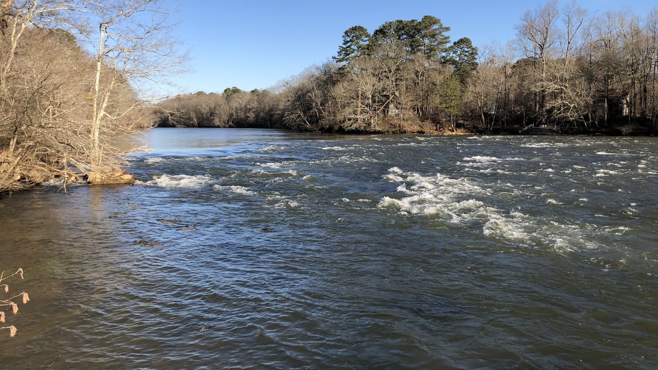
This phrase does a lot of work and it is worth understanding literally. Georgia's Environmental Protection Division field guide describes wrested vegetation as the result of water movement that removes soil, debris, and vegetation, creating a clear demarcation between the flow of water and vegetative growth. Field indicators include exposed rock, gravel, or sand and visible scour marks.
The consequence is counterintuitive: where there is no wrested vegetation, there is no state buffer. Fully vegetated banks, riprap lined channels, and bulkheads can all lack the point from which the buffer is measured. Perennial and intermittent streams are buffered if wrested vegetation is present. Non trout ephemeral streams are not. For impoundments, measurement starts at the wrested vegetation point rather than at normal pool elevation. This measurement rule was settled by the Georgia Supreme Court in 2015 in litigation involving the Georgia River Network, which confirmed that waters lacking wrested vegetation get no buffer because there is no point from which to measure.
Section 12-7-6(b)(15)(B) provides that no land disturbing activities may be conducted within the buffer until the remainder of the site is stabilized. After stabilization, thinning of vegetation is allowed if protective cover remains. Statutory exemptions include variances approved by the EPD Director, drainage and roadway structures with erosion controls in place, ephemeral streams, and shoreline stabilization on Lakes Oconee and Sinclair.
Most metro Atlanta buyers assume trout streams are a mountain county issue. They are not.
Section 12-7-6(b)(16) establishes a 50 foot buffer, measured the same way from the wrested vegetation point, along the banks of any state waters classified as trout streams. Small springs and trout streams discharging 25 gallons per minute or less may use a 25 foot buffer or be piped at the landowner's discretion.
EPD's compiled trout stream designation list identifies Secondary Trout Waters in all three counties. In Cobb, the Chattahoochee River upstream from the I-285 West Bridge. In Cherokee, the Bluff Creek watershed upstream from County Road 114, Boston Creek, Murphy Creek, Pine Log Creek, Salacoa Creek, Soap Creek upstream from County Road 116, Stamp Creek, and Wiley Creek. In Paulding, Possum Creek upstream from County Road 64, Powder Creek, Pumpkinvine Creek upstream from County Road 231, Pyle Creek, Raccoon Creek upstream from Road SR2299, the Tallapoosa River, Simpson Creek, Thompson Creek, and Ward Creek. Primary Trout Waters are concentrated in mountain counties such as Rabun, Union, Towns, White, Lumpkin, Fannin, Gilmer, Murray, Pickens, Dawson, and Stephens.
The practical takeaway is that a lot backing up to Pumpkinvine Creek in Paulding or Stamp Creek in Cherokee may be carrying a 50 foot state buffer rather than a 25 foot one, and nothing about the appearance of the water tells you that.
The state number is a floor, not a ceiling. Local governments across metro Atlanta impose wider buffers, and they frequently measure them from a different starting line.
The Metropolitan North Georgia Water Planning District publishes a Model Stream Buffer Protection Ordinance that local governments in the district adopt. It calls for an undisturbed natural vegetative buffer maintained for 50 feet on both banks, measured from the top of the stream bank, plus an additional 25 foot setback beyond the buffer in which all impervious cover is prohibited. Land development activities, septic tanks, and drain fields are prohibited in the buffer. Variances are limited to unusual property shape or topography creating extreme hardship, and they require public hearings and mitigation.
Cobb is the most complex of the three because its width scales with the size of the watershed feeding the stream. Under the Official Code of Cobb County section 50-75(b)(15), measured from the wrested vegetation point, the buffer is 25 feet on state waters not shown on the current county stream buffer map; 50 feet where the intercepted watershed area is five square miles or less, plus an additional 25 foot impervious setback; 75 feet where the watershed area is between five and ten square miles; 100 feet where it exceeds ten square miles; and 200 feet on Nickajack Creek along two defined reaches. The 50 foot trout stream buffer also applies.
Note what this means in practice. The applicable width in Cobb is driven by a published county stream buffer map, distributed as twenty separate tiles with an index map used to identify which tile covers a given property. A surveyor cannot derive the correct width from the lot alone. Somebody has to pull the right tile.
Cherokee County's Stream Buffer Protection Ordinance, adopted July 19, 2005, requires an undisturbed natural vegetative buffer of 50 feet on both banks, measured from the top of the stream bank, plus an additional 25 foot setback in which all impervious cover is prohibited. On the Etowah River and the Little River, the undisturbed natural buffer is 150 feet on both sides. Septic tanks, drain fields, and land development activities are prohibited in the buffer. The full text is posted as the Cherokee County Stream Buffer Protection Ordinance.
Paulding County also maintains a stream buffer ordinance within its development regulations. We were not able to independently confirm its widths from a primary source, so no numbers are stated here. Anyone evaluating a Paulding parcel with a stream should request the current widths directly from the county's development department rather than assuming the state minimum applies.
Both of these come straight out of the ordinance language, and both are avoidable.
The state buffer and Cobb's code run from the point of wrested vegetation. Cherokee's ordinance and the District model ordinance run from the top of the stream bank. Those are different lines on the ground, sometimes by a meaningful distance on a shallow sloping bank. A plat that shows one of them does not establish the other. If a survey shows a buffer line, the first question is which datum it was measured from and which ordinance it was drawn to satisfy.
Cherokee's ordinance makes this explicit. Section 5.2(1) allows the Cherokee County Zoning Board of Appeals to grant a variance from the local buffer and setback. Section 5.2(3) states that any variance to the required 25 foot State Waters Buffer must be made to the Director of the Environmental Protection Division. Two separate approvals, two separate bodies. Clearing one does not clear the other, and a contractor who tells you the county signed off has answered only half the question.
The state variance is a real, working process, not a theoretical one.
EPD publishes three separate variance application forms, all revised in October 2025: 25 foot warm waters, 50 foot trout waters, and 25 foot coastal marshlands. They are posted on EPD's erosion and sedimentation forms page. The application asks for owner and contact information, project name and type, total disturbed acreage, county, GPS coordinates, watershed, and affected waterway, plus the buffer disturbance stated in both linear feet and square feet. Attachments include site plans, a location map, a USGS quad sheet, a letter from the local issuing authority, any Army Corps of Engineers permit documents, an erosion sedimentation and pollution control plan, a revegetation or buffer mitigation plan, and a stormwater control plan. A fifteen item buffer impact checklist is also required. Applications go to the Erosion and Sedimentation Control Unit at 2 Martin Luther King Jr Drive SW in Atlanta.
The criteria in Georgia Comp. R. and Regs. 391-3-7-.05 cover infrastructure, water quality and habitat restoration, reasonable property access, water and sewer and utility crossings, recreational trails, single family homes where construction began before January 10, 2005, and Corps permitted projects. Buffer impacts under 5,000 square feet are classified as minor. A guidebook published by the Georgia Department of Transportation for its own projects describes an initial review within twenty business days, a thirty calendar day public comment period after the public advisory publishes, and ten business days to approve or deny after comment closes, for roughly two and a half months from submittal of a complete application. That timeline is documented for transportation projects rather than homeowner applications, so treat it as indicative rather than a guarantee.
EPD posts pending requests for public review by county group on its buffer variance public advisories page and offers email notification. That page is also a useful diligence tool: it will tell you if a neighbor has an application pending.
Four requests cover most of the exposure on a lot with water on it. Ask for a survey that locates the stream and states which buffer datum was used. Ask the county development or engineering department, in writing, which buffer widths apply to the specific parcel, and in Cobb, ask which map tile governs. Ask for the recorded plat, since Cherokee's ordinance requires buffer and setback areas to be recorded on the final plat following plan approval. And if any part of your plan touches the buffer, ask the timeline question early, because a state variance is measured in months, not days.
Buyers evaluating rural and semi rural lots will find related ground in our explainer on why the county line matters when you buy, since the buffer ordinance that governs your lot is a county ordinance and the differences between adjacent counties are substantial.
How wide is Georgia's stream buffer? The state minimum is 25 feet along the banks of state waters, measured horizontally from the point where vegetation has been wrested by normal stream flow or wave action. Waters classified as trout streams carry a 50 foot state buffer.
Can a county require a wider buffer than the state? Yes. Cherokee County requires 50 feet plus a 25 foot impervious setback, and 150 feet on the Etowah and Little Rivers. Cobb County scales its buffer from 25 to 200 feet depending on the watershed area and the county stream buffer map.
Are there trout streams in metro Atlanta counties? Yes. EPD's designation list identifies Secondary Trout Waters in Cobb, Cherokee, and Paulding County, which triggers the wider 50 foot state buffer on those reaches.
Can you get permission to build inside a buffer? There is a variance process through the Environmental Protection Division, with published application forms and defined criteria. A variance from a local buffer granted by a county board does not substitute for a state variance where the state buffer applies.
A stream on the property is not a problem. An unmeasured stream on the property is. The buffer question has a definite answer for any given parcel, and the answer comes from three places: the statute, the county ordinance, and in Cobb, the correct map tile. Get all three before you decide where the house, the drive, the septic field, or the outbuilding is going, because moving those lines afterward means a variance application and a public comment period.
Clareo Group, powered by The Agency Atlanta, sells lots and acreage across Cobb, Cherokee, and Paulding, and we treat a creek on the survey as a diligence item with a deadline rather than a selling point to mention and move past. Reach out before you write the offer and we will map the questions to ask the county.
Start Your New Home Search Now!
Stay up to date on the latest real estate trends.
You’ve got questions, and we can’t wait to answer them.